Getting started
Install Ring Guide from the App Store and open it. That's the whole setup: there's no account, no sign-up and no email to hand over. The map and all 166 places are built into the app, so they're there the moment it opens.
Do one thing before you travel, though: download the offline maps while you're still on Wi-Fi. Coverage in the Eifel is patchy, and that download is what keeps the map drawing when the signal goes.
Do this before you go
Download the maps and read the Trip info at home. Both are far easier on the sofa than in a lay-by outside Adenau with one bar of signal.
The map
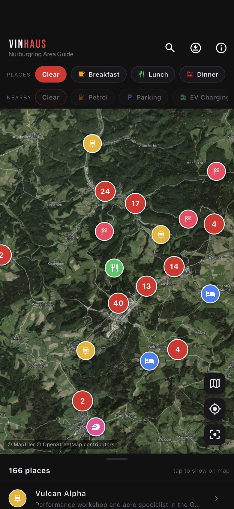
The map opens on the whole Nürburgring area with every place pinned on it. Each pin is a coloured circle carrying its category icon. Where pins are packed close together they collapse into a red bubble with a count in it: zoom in, or tap the bubble, and it opens back out into individual pins.
The three buttons on the right
Stacked in the bottom-right corner, top to bottom:
- Layers switches between satellite (imagery with road labels over it) and a dark street map. The app starts on satellite.
- Locate drops a blue dot on your position and pans to it. It'll ask for location permission the first time.
- Recentre pulls the map back to the ring if you've wandered off across Germany.
Attribution
Bottom-left of the map you'll see © MapTiler © OpenStreetMap contributors. Tap it to open the full Licences & credits screen.
Finding a place
Three ways in, and they all work together. Whatever you filter or search for, the map and the list stay in step.
Categories
The PLACES row along the top filters the 166 curated places by category: Breakfast, Lunch, Dinner, Vegan, Coffee, Hotels, Sights, Track spots, Drives & Views, Garage, Car Wash, Parking, Shops, Cash, Activities, Bike hire, Nightlife and Towns. Tap chips to narrow things down.
The chip on the left is a shortcut that reads your selection: it says All when you've filtered down to something, and turns red and says Clear when everything is showing. Tap it to flip between the two.
Search
Tap the search icon in the top bar and type. It filters as you go, on both the map and the list. Tap the to close it and get everything back.
The list
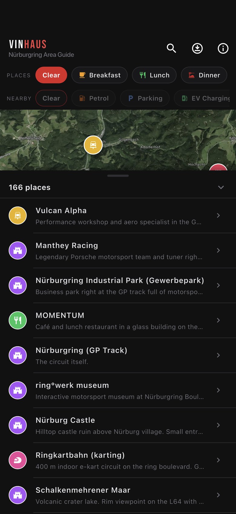
The panel peeking up from the bottom of the map is the same set of places as a list. Its header counts what you're looking at ("166 places", or fewer once you filter) and drag anywhere on it to pull it up. Tap a row and the map flies to that place and opens its details.
Place details
Tapping a pin or a list row slides up a sheet with the name, the category, and a description explaining what the place is and why it's worth your time. Then a row of buttons, which vary by place because we only show the ones we actually have:
| Button | What it does |
|---|---|
| Open in Maps | Hands off to your maps app for directions. Every place has this one. |
| Waze | Same, in Waze instead. |
| Call | Rings the place. On 97 of the 166. |
| Website | Opens their site in your browser. On 113 places. |
| Book | Opens a booking page. On 13 places, mostly hotels. |
| TripAdvisor | Opens the reviews. On 88 places. |
| Share | Sends the name, description and a maps link to anyone you like. |
"Approx. location"
If the category line reads · approx. location, the pin is in the right area but not on the exact doorstep. It's a deliberate flag, not a bug: better an honest approximation than a pin that walks you into a field. Everything else is placed exactly.
Driving routes
17 of the places are drives rather than destinations, in the Drives & Views category. They carry a route icon in the list instead of the usual arrow.
Tap one and the app draws the whole run on the map as a line, and a banner appears at the top naming it, for instance "Route: Deutsche Vulkanstraße". Only one route shows at a time, so overlapping drives never turn into spaghetti. Tap the on the banner to clear it.
The drawn line is stored inside the app, so it still appears with no signal. The Open route button on the sheet is the exception: that hands the route off to your maps app and needs a connection.
Nearby essentials
Separate from the 166 curated places, the NEARBY row adds practical stuff pulled from OpenStreetMap: Petrol, Parking, EV Charging, Attractions, Viewpoints, Camping and Bars & Cafés. It runs to over 6,000 points, so it's off by default. Tap a chip to switch a layer on, and the Clear chip to turn the lot off.
These aren't hand-written like the curated places, so their sheets are simpler: a name, the layer it came from, and Maps and Waze buttons. No description, because we haven't been to all six thousand of them.
Trip info
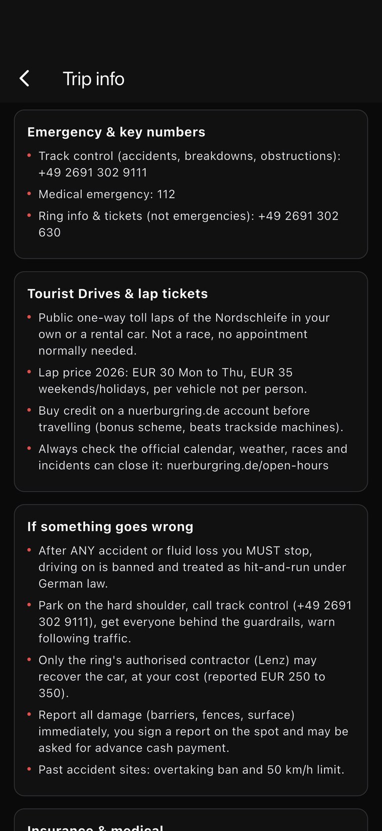
The icon in the top bar opens Trip info: 14 sections of the things worth knowing before you drive, written for people going for the first time. It covers emergency and key numbers, tourist drives and lap tickets, what to do if something goes wrong, insurance and medical, track etiquette and rules, best times to visit, best days for car spotting, what to bring, photo locations, driving routes, itineraries, booking early, respecting the region, and a top 10.
Below that, Useful links points at the official sources for the things that change: the tourist drive calendar and lap credit, the events calendar, the 24h race, the NLS endurance series and more. Those open in your browser, so they need a signal.
Always check the official source
Opening times, lap prices and closures move around, and the app can't know when. Trip info tells you where to look. It isn't a substitute for looking.
The same screen is also the way through to Offline maps and Licences & credits, at the bottom.
Offline maps
This is the one bit of setup worth doing properly. Reach it from the icon in the top bar, or from the bottom of Trip info.
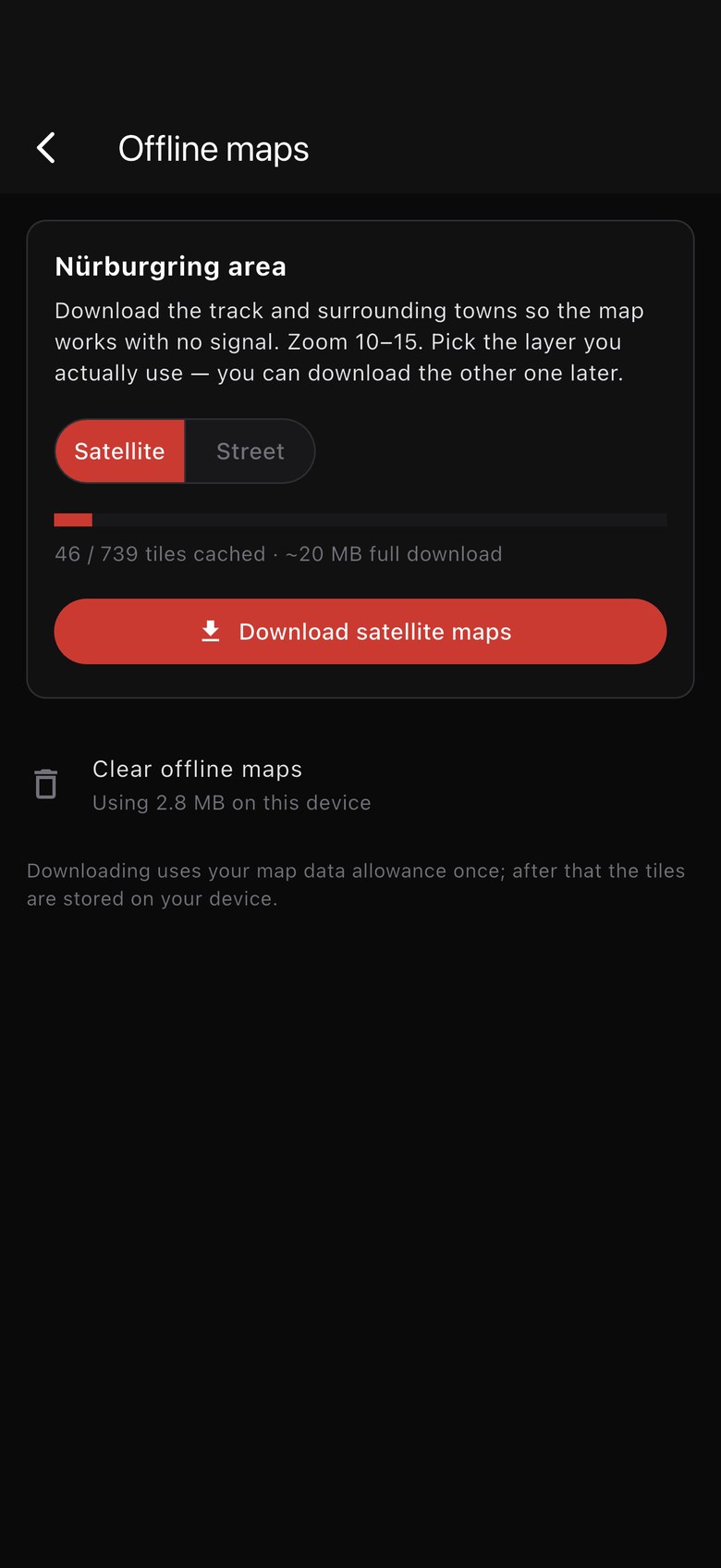
The app pre-caches the map tiles for the ring and the towns around it (Adenau, Nürburg, Meuspath, out to the edge of Kelberg), at zoom levels 10 to 15. That's close enough to find a specific building, and the area is deliberately kept tight so the download stays a sensible size.
Pick a layer first
You download one layer at a time, chosen with the Satellite / Street switch. Each is roughly 739 tiles, about 20 MB. Download the one you actually use, and come back for the other later if you want it. Satellite is the app's default, so if you're not sure, take that one.
Downloading
- Tap Download satellite maps (or street) and the bar tracks it, tile by tile.
- Stop cancels. Nothing is lost: whatever came down is kept, and starting again skips what you already have.
- Once it's done the button becomes Re-check / update, for topping up later.
- Clear offline maps deletes the tiles and gives the space back. It shows what's currently in use on the device. Your places and details stay put; only the map background needs a signal again.
The download uses your data allowance once. After that the tiles live on your phone.
What needs a signal
Worth being straight about, because it's the difference between a useful afternoon and a stranded one. Ring Guide shows you where everything is. It is not a sat nav — there's no turn-by-turn navigation in it at all.
Works with no signal
- The map itself, once you've downloaded it
- All 166 pins and their descriptions
- Categories, search and the list
- The 17 drive routes drawn on the map
- All 14 Trip info sections
- Your own position via GPS
- The Call button, on normal signal
Needs a connection
- Open in Maps and Waze
- Open route on a drive
- Website Book and TripAdvisor
- The Useful links in Trip info
- Map areas you didn't download, or zoomed past level 15
So: plan on the app, then get there with your maps app while you still have signal, or the old-fashioned way once you don't. GPS itself doesn't need a mobile signal, so the blue dot showing your position on a downloaded map keeps working in the middle of nowhere. That plus a downloaded map will get you found.
Privacy & permissions
Ring Guide has no account, no sign-up and no analytics. Nothing about you is collected or sent anywhere.
The app asks for location once, the first time you tap the locate button. It's used on your device to draw the blue dot showing where you are, and that's the extent of it: your position is never transmitted, stored or shared. Say no and everything else still works, the app just can't show you where you are. You can change your mind later in the iOS Settings app under Ring Guide.
The full detail is in the privacy policy.
Getting help
Something's wrong or missing
A place closed down, a pin in the wrong spot, somewhere good we've missed? Email support@vinhaus.co.uk and we'll get it into the next data refresh. Local knowledge is genuinely welcome.
The map is blank or won't load
Almost always signal. Check your connection, or download the area for offline use before you travel. If a downloaded area looks patchy, run Re-check / update on Wi-Fi to fill in the gaps.
Location isn't showing
Check that location permission is granted for Ring Guide in the iOS Settings app.
Licences & credits
At the bottom of Trip info, or by tapping the attribution on the map. It credits the map data and imagery, the Bebas Neue typeface, the open-source packages the app is built on, and sets out the trademark position.
More answers on the support page, or the FAQ.